 |
| Vermilion River |
Later as an adult, eating at a restaurant in Carencro, I recall looking at an old map of the town hanging in a frame on the wall. What immediately struck me as odd was off on the left side, printed in large text, "Spanish Territory" (or something similar) pointing slightly west of the town limits. I was intrigued.
Tracking down the answers to these questions wasn't easy. It all begins in 1682 with the French La Salle declaring all lands of the entire area of the Mississippi watershed, including the tributaries, to be named after king Louis XIV of France. But what that exactly meant was uncertain since not even the French had explored everything that fed into the river. Clearly, the Ohio River valley and the Missouri River valley, but the Red-White River area and the lower portion of the river was still uncertain where the exact borders lay. In fact, no country knew the exact borders at all.
While in school, I would routinely run across maps like this one, showing a subset of south Louisiana.

Clearly, one would ponder why The Purchase's south-western border ran so far easterly into the state interior near the Gulf of Mexico. Here's another:

The big question is: If enforced, would we have not become part of Spain and eventually Spanish Texas? Spain could have enforced this "Mississippi watershed only" clause. They could have fought for all of the land that technically wasn't part of the Mississippi watershed. I never stopped to think that there were areas in present-day Louisiana that have nothing to do with the river.
The Case For the Calcasieu
 |
| No Man's Land Between Sabine and Calcasieu |
This seems to be the most eastern border Spain argued over. Luckily, maps at the time were often inaccurate and many names were used for the same river.
The Case For the Mermentau
If we stare carefully at the Mermentau river basin, we notice something surprising as well. It also has no natural connection to the Mississippi River. It is composed of 4 major bayous and a host of smaller coulees that form a watershed all on it's own. This watershed is practically on the backdoor of the city of Lafayette. And yet, the US would have had no claim to it at all while bargaining over the purchase of Louisiana.
 |
| Mermentau River Basin |
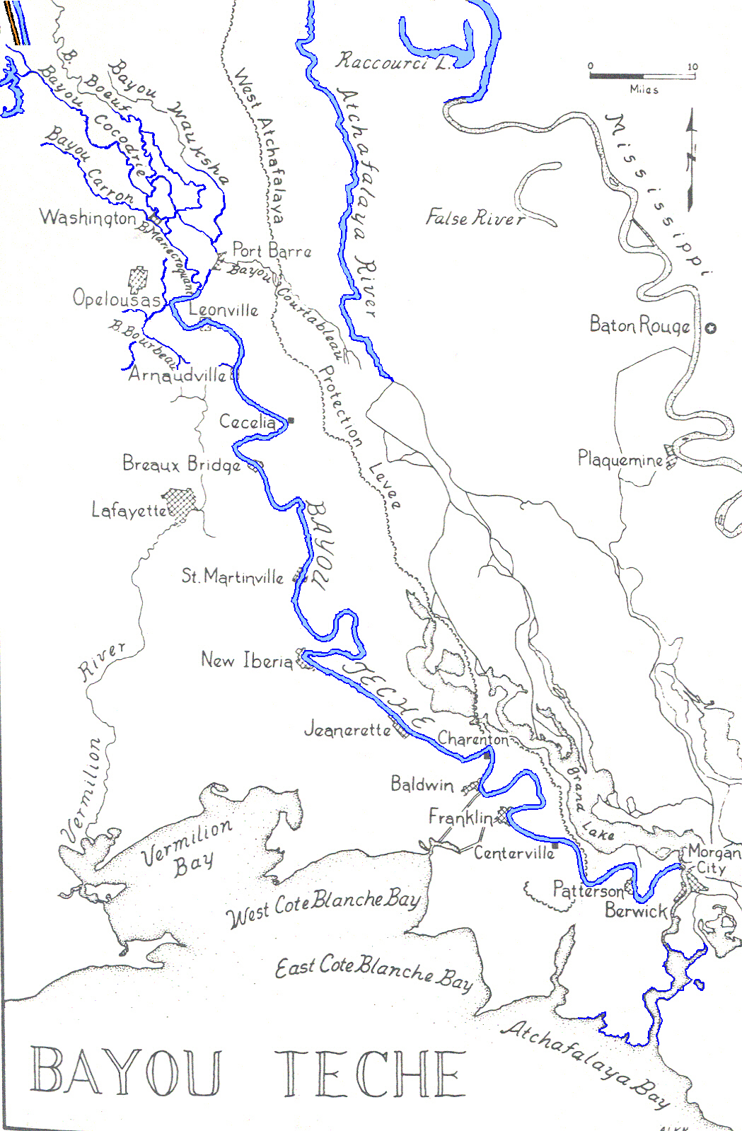
The Case For The Vermilion and Bayou Teche
As we look across east, the next two major waterways are the Vermilion River and the Bayou Teche. While the Bayou Teche flows into the Atchafalya, which was originally a tributary of the Mississippi/Red River junction, the Vermilion is allegedly a small bayou which formed up from the Gulf of Mexico. It has no connection to the either major rivers. This river seems to match up most closely to the line drawn on the Louisiana Purchase maps leading down to Vermilion Bay.
 |
| Vermilion River |
 |
| Lafayette Parish and the Vermilion River |
I can only imagine what life would have been like looking across the Vermilion and seeing a different state all together.
 |
| Both sides of the Vermilion |
While the Vermilion gets it's water pumped from Bayou Courtableau, it wasn't always the case. Most maps show it as a river all to it's own. Even some suggest the Teche was too. Given the Vermilion technically falls within the description of Spanish Texas territory, even the Bayou Teche could have become the frontier border with the Louisiana Purchase. We could be living in Lafayette County instead; celebrating Texas independence instead of Bienville's founding of the territory.
 |
| Waterway Drainage |
There is a letter in which the Spanish, writing in the 1750s, complain about Frenchman Andre Masse being on their "turf". (He was on Bayou Teche.) But because the French were in nearby New Orleans, and because France and Spain both had Bourbon kings united against England in times of strife, the Viceroy of Mexico didn't want to push the issue. So he let Masse stay, unable to reach him because Masse sat in a sort of no-man's land claimed by both sides.
Luckily, the border arguments remained much further west. According to Bernard:
As best I can tell, the Spanish just grumbled among themselves that they owned south-west Louisiana, and made maps to that effect, but never actually tried to seize it. Of course, the capital of Texas was in present-day Louisiana (near Nachitoches) up until the 1770s, but they didn't push beyond that line.
 |
| Aaron Arrowsmith Map, 1810. Showing "Texas" stretching to the "Mermento River" |
By 1819, US Secretary of State John Quincy Adams and Spanish foreign minister Luis de Onís y González-Vara signed an agreement fixing the border between Louisiana and Spanish Texas to be at the Sabine River; known as the Adams-Onís Treaty. This left Lafayette firmly in the hands of the US and eventually part of the State of Louisiana. By 1840, Texas was independent and erected an "international border marker" between Louisiana and Texas north of the Sabine. Even then, the exact location within the river didn't become completely settled until the 1970s when both states moved the boundary from the western landfall of the Sabine River to the center of the body of water which it remains to this day.
 |
| International Border Marker from 1840 between Texas and Louisiana |
- http://la.water.usgs.gov/publications/pdfs/TR30.pdf
- http://etc.usf.edu/maps/pages/2300/2383/2383.htm
- http://www.loc.gov/collections/louisiana-european-explorations-and-the-louisiana-purchase/articles-and-essays/a-question-of-boundaries/
- https://upload.wikimedia.org/wikipedia/commons/2/29/UnitedStatesExpansion.png
- http://www.loc.gov/collections/static/louisiana-european-explorations-and-the-louisiana-purchase/images/lapurchase.pdf
- http://www.onlyinyourstate.com/louisiana/unique-sights-in-la/